Support our educational content for free when you purchase through links on our site. Learn more
How Big Is Jacksonville, Florida? Discover 10 Jaw-Dropping Facts (2025) 🌴
Ever wondered just how big Jacksonville, Florida really is? Spoiler alert: it’s not just big—it’s massive. Stretching over 874 square miles, Jacksonville is the largest city by land area in the continental United States. But what does that actually mean for residents and visitors? From sprawling neighborhoods and 22 miles of beaches to a river that flows north (yes, north!) and a ferry that’s the only one of its kind in Florida, Jacksonville’s size shapes everything about its culture, economy, and lifestyle.
Stick with us as we dive into 10 jaw-dropping facts about Jacksonville’s geography, history, demographics, and more. You’ll discover why this city’s vastness is both a blessing and a challenge—and how it might just change the way you think about urban living. Plus, we’ll share insider tips on exploring hidden corners of this giant city that most visitors never see!
Key Takeaways
- Jacksonville covers 874.46 square miles, making it the largest city by land area in the continental U.S.
- The city’s population exceeds 1 million, but density remains low due to sprawling neighborhoods and vast green spaces.
- The St. Johns River, flowing north through the city, creates unique geography and transportation challenges.
- Jacksonville’s 1968 city-county consolidation dramatically expanded its boundaries overnight.
- The city boasts the largest urban park system in the U.S., with over 80,000 acres of parks and preserves.
- Its size supports a diverse economy including major seaports, military bases, and corporate headquarters.
- Transportation includes seven river bridges, a public ferry, and a modest Skyway system, but car travel dominates.
- Jacksonville’s sprawling layout fosters distinct neighborhood identities—from beach communities to rural horse farms.
Ready to explore the city that’s big enough to swallow Miami, Tampa, and Orlando combined? Let’s get started!
Table of Contents
- ⚡️ Quick Tips and Facts About Jacksonville’s Size
- 🌴 Jacksonville’s Geographic Footprint: How Big Is It Really?
- 📜 The Evolution of Jacksonville’s Size: A Historical Perspective
- 👥 Population and Demographics: Who Calls Jacksonville Home?
- 🏙️ Jacksonville’s Neighborhoods and Districts: Size and Diversity
- 💼 Economic Impact of Jacksonville’s Size: Business and Industry
- 🚦 Infrastructure and Transportation: Managing a Massive City
- 🌎 Jacksonville’s Regional Influence: Size and Significance in Florida and Beyond
- 🎉 Culture and Lifestyle: How Size Shapes Jacksonville’s Identity
- 🏛️ Government and Urban Planning: Governing a Giant
- 📚 Education and Community Services Across Jacksonville’s Vast Area
- 🌐 Sister Cities and International Connections
- 📝 Notes and Interesting Tidbits About Jacksonville’s Size
- 🔗 Recommended Links for Exploring Jacksonville
- ❓ Frequently Asked Questions About Jacksonville’s Size
- 📚 Reference Links and Sources
- 🎯 Conclusion: Why Jacksonville’s Size Matters to You
⚡️ Quick Tips and Facts About Jacksonville’s Size
- 874.46 square miles – that’s how big Jacksonville, Florida is.
- Largest city by land area in the contiguous U.S. (sorry, Anchorage, you’re gorgeous but you’re in Alaska).
- 22 miles of Atlantic beaches inside city limits—no day-trip required.
- 1,100 miles of shoreline total—more than any other city in Florida.
- 80,000 acres of parkland—four times the size of Manhattan.
- 270 days of sunshine a year—plenty of time to explore every last acre.
- Population ~1 million inside city limits, 1.7 million in the metro—Florida’s biggest city proper.
- Only public auto ferry in Florida: the St. Johns River Ferry—yes, it’s inside Jacksonville.
Need a one-liner for trivia night? “Jax is big enough to swallow Miami, Tampa, Orlando, and St. Pete—combined—and still have room for dessert.” 🍰
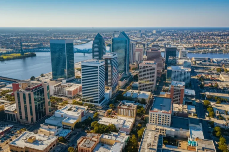
🌴 Jacksonville’s Geographic Footprint: How Big Is It Really?
We locals joke that our GPS thinks “arrived at destination” is optional. Jacksonville’s 874.46 square miles stretch from the salt marshes of Nassau County to the clay bluffs of Clay County. To put that in perspective:
| City | Land Area (sq mi) | Jacksonville Could Swallow It |
|---|---|---|
| Miami | 36 | ✅ 24 times |
| Tampa | 114 | ✅ 7.5 times |
| Atlanta | 134 | ✅ 6.5 times |
| New York City | 302 | ✅ 2.9 times |
Translation: you can fit NYC, Boston, Pittsburgh, and San Francisco inside Jacksonville city limits and still have 30 square miles left over for a backyard BBQ.
Waterways and Natural Boundaries That Shape Jacksonville
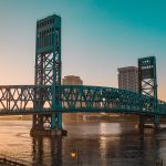
The St. Johns River—Florida’s longest river—runs 310 miles, and the longest stretch cuts straight through Jacksonville, flowing north (yes, north, like salmon-on-vacation north). Add 1,100 miles of shoreline (rivers, creeks, Intracoastal, ocean) and you get a city where a 15-minute commute can involve a drawbridge, a ferry, and a pod of dolphins. 🐬
📜 The Evolution of Jacksonville’s Size: A Historical Perspective
Jacksonville wasn’t always a mega-city. In 1822, it was a 14-block settlement named after Andrew Jackson (love him or hate him, we kept the name). Then came the Great Fire of 1901, torching 146 city blocks and forcing a rebuild. But the real growth spurt happened in 1968 with the City-County Consolidation, merging city and Duval County governments into one super-sized municipality.
City Consolidation and Expansion Milestones
| Year | Milestone | Size Impact |
|---|---|---|
| 1822 | Town plat | 1 sq mi |
| 1901 | Post-fire rebuild | 20 sq mi annexed |
| 1968 | Consolidation | 900 sq mi overnight |
| 1990s | Baldwin & beaches annexation | 874.46 sq mi today |
Insider scoop: the town of Baldwin is completely surrounded by Jacksonville—like a donut hole inside the donut. 🍩
👥 Population and Demographics: Who Calls Jacksonville Home?
2024 estimate: 1,009,833 people inside city limits, making Jacksonville the most populous city in Florida and the 11th largest in the U.S. But spread that million across 874 square miles and density drops to 1,200 people per square mile—half that of Tampa, a quarter of Miami.
Population Density and Urban Spread
- Urban core (Downtown, Riverside, San Marco): 3,000–5,000 per sq mi
- Suburban sprawl (Mandarin, Southside, Arlington): 1,500–2,500 per sq mi
- Rural fringe (Northwest, Westside): <500 per sq mi—horses outnumber stoplights. 🐴
Jax Facts™ Demographics Hub: Jacksonville Demographics
🏙️ Jacksonville’s Neighborhoods and Districts: Size and Diversity
Over 500 distinct neighborhoods—from beach bungalows to riverfront mansions—grouped into six mega-areas: Northside, Westside, Arlington, Southside, Urban Core, and the Beaches.
Largest Neighborhoods by Area
| Neighborhood | Approx. Area (sq mi) | Vibe Check |
|---|---|---|
| Cecil Field | 42 | Former naval air station, now spaceport & equestrian trails |
| Tallyrand | 9 | Industrial riverfront, cigar history |
| Mandarin | 35 | Live oaks, Southern charm, killer Thai food |
| Arlington | 54 | Mid-century suburbs, hidden lakes |
| Oceanway | 48 | Rural pockets, goat yoga studios |
Cultural and Economic Hubs
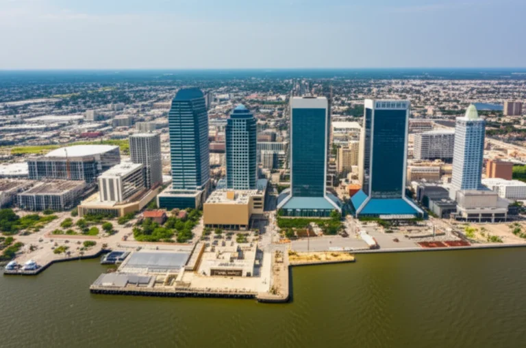
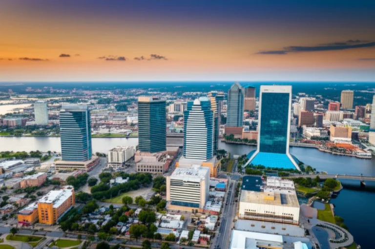
- Downtown: 1.6 sq mi, but packs 9–5 energy, the Bank of America Tower (617 ft), and the Florida Theatre (1927).
- Five Points (Riverside): walkable, bohemian, craft-beer central.
- Town Center (Southside): open-air shopping mecca, bigger than some island nations.
Jax Facts™ Geography Hub: Jacksonville Geography
💼 Economic Impact of Jacksonville’s Size: Business and Industry
Size equals opportunity. JAXPORT—the largest seaport in Florida by volume—sits on 1,100 acres with three marine terminals. Add three naval bases (NAS Jacksonville, NS Mayport, Blount Island) and you get the third-largest military presence in the U.S.
Major employers by sector:
- Logistics: CSX Corporation, JAXPORT, Amazon fulfillment centers
- Finance: Fidelity National Financial, FIS, Bank of America
- Healthcare: Baptist Health, Mayo Clinic, UF Health
- Aviation: Fanatics, Saft, Defense contractors
👉 CHECK PRICE on:
- CSX Railroad Models: Amazon | Etsy | CSX Official
- Jaguars Fan Gear: Amazon | Walmart | Fanatics Official
🚦 Infrastructure and Transportation: Managing a Massive City
Seven bridges cross the St. Johns River inside city limits. I-95 and I-10 intersect here—think of it as the Times Square of asphalt. The Jacksonville Skyway (2.5 miles) is cute but under-used; locals call it the “ride to nowhere.”
Commute realities:
- Average one-way: 26 minutes (below national avg)
- Longest possible straight-line drive inside city limits: 52 miles (Cecil Field to Mayport)
- Public transit: JTA buses, Skyway, ferry, water taxi—but you’ll still need a car. 🚗
Pro tip: Use the St. Johns River Ferry (free for pedestrians) for sunset views and to skip 30 miles of driving around the river. 🌅
🌎 Jacksonville’s Regional Influence: Size and Significance in Florida and Beyond
Jacksonville’s footprint spills influence into five counties: Duval, Nassau, Clay, St. Johns, and Baker. The metro GDP tops $90 billion, ranking 4th in Florida behind Miami, Tampa, and Orlando. Translation: we’re the economic engine for North Florida.
Regional perks:
- Air service: JAX airport—70+ nonstop routes, 5.5 million passengers/year
- Rail: CSX, Amtrak, future Brightline stop (2030?)
- Ports: JAXPORT moves 1.3 million containers annually—largest in FL by tonnage
Jax Facts™ Beaches Hub: Jacksonville Beaches
🎉 Culture and Lifestyle: How Size Shapes Jacksonville’s Identity
Ever tried bar-hopping in a city where the next pub is 20 miles away? Jacksonville’s size breeds hyper-local pride: beaches kids vs. Westside cowboys vs. Urban Core hipsters.
Cultural scorecard:
- 22 miles of beaches—surf before work, catch free concerts at Seawalk Pavilion.
- Largest urban park system—80,000 acres, including Timucuan Preserve (46,000 acres).
- Music scene: birthplace of Southern Rock (Lynyrd Skynyrd, Molly Hatchet).
- Foodie cred: “Best City to Eat in America” —Thrillist. Try Mayport shrimp, camel rider sandwiches, Goo Goo Clusters (okay, those are from Nashville, but we eat them anyway).
Jax Facts™ Education Hub: Jacksonville Education
🏛️ Government and Urban Planning: Governing a Giant
Mayor-Council system—one mayor, 19 city council districts. Because of consolidation, Duval County = City of Jacksonville. That means one property tax bill, one school district, one sheriff for 874 square miles.
Zoning quirks:
- Agricultural zones inside city limits—yes, we have horse farms 15 minutes from downtown.
- Height restrictions near airports—downtown skyline tops out at 617 ft (Bank of America Tower).
- Future land use plan aims to infill urban core instead of sprawl—50,000 new housing units targeted by 2040.
📚 Education and Community Services Across Jacksonville’s Vast Area
Duval County Public Schools—196 schools, 130,000 students, area larger than Rhode Island. Buses drive 18 million miles annually—enough to go to the moon and back 37 times.
Higher ed footprint:
- University of North Florida—1,300 acres, 17,000 students, own nature preserve
- Jacksonville University—riverfront campus, Division I dolphins
- Florida State College at Jacksonville—five campuses across the city
Library system: 21 branches, 4 million visits/year, largest in FL by area served.
🌐 Sister Cities and International Connections
Jacksonville’s size earns global friends. Sister cities include:
- Nantes, France (historic ties to Fort Caroline)
- Murmansk, Russia (naval port kinship)
- Bahía Blanca, Argentina (trade & culture)
- Yingkou, China (port partnership)
Exchange programs, trade delegations, and yes, soccer friendlies keep Jax connected despite the sprawl.
📝 Notes and Interesting Tidbits About Jacksonville’s Size
- Treaty Oak—25 ft circumference, 70 ft tall, 200+ years old—older than the city itself.
- Dames Point Bridge—two miles long, second-longest concrete cable-stayed bridge in the Western Hemisphere.
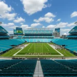
- EverBank Stadium—only NFL stadium with swimming pools in the end zone—because why not?
- First YouTube video perspective: the narrator jokes that if Jacksonville truly felt like the 11th largest city, the skyline would be overwhelming; instead, the sprawl keeps it humble. Watch the full take here.
Jax Facts™ Facts Hub: Jacksonville Facts
Still wondering how big Jacksonville, Florida is? Big enough to hide entire civilizations of manatees, ghost towns of 1901 bricks, and secret surf spots only locals know. Stick around—next we’ll tell you why all that space matters to your weekend plans.
🎯 Conclusion: Why Jacksonville’s Size Matters to You

So, how big is Jacksonville, Florida? Massive—the largest city by land area in the continental United States, sprawling over 874 square miles, with a population crossing the one million mark. But it’s not just about numbers. Jacksonville’s size shapes its diverse neighborhoods, vast natural preserves, economic clout, and laid-back lifestyle. Whether you’re a beach bum, a history buff, a business traveler, or a family looking for room to grow, Jax’s size offers something uniquely expansive and inviting.
We teased earlier about how Jacksonville’s size affects your weekend plans—well, now you know why you can surf in the morning, hike in the afternoon, and catch a jazz festival downtown by night without ever feeling cramped. The city’s urban sprawl is both a blessing and a challenge, creating a patchwork of cultures, landscapes, and opportunities that few other cities can match.
If you’re considering moving here, visiting, or just curious, understanding Jacksonville’s size is key to unlocking its character. It’s a city that wears its vastness like a badge of honor, inviting you to explore every inch.
🔗 Recommended Links for Exploring Jacksonville
-
CSX Railroad Models:
Amazon | Etsy | CSX Official Website -
Jacksonville Jaguars Fan Gear:
Amazon | Walmart | Fanatics Official Website -
Books on Jacksonville History and Geography:
- Jacksonville: The Consolidation Story by Wayne Wood
- Jacksonville’s Beaches: A Photographic History by David Cook
- The St. Johns River: Florida’s Forgotten Frontier by James G. Cusick
Find these on Amazon
❓ Frequently Asked Questions About Jacksonville’s Size
Is Jacksonville one of the biggest cities in the US?
Absolutely! Jacksonville ranks as the largest city by land area in the contiguous United States, covering about 874 square miles. While cities like Anchorage in Alaska are larger, Jacksonville holds the crown for the continental U.S., making it a geographic giant. This size is due to the 1968 city-county consolidation, which merged Jacksonville with Duval County, vastly expanding its boundaries.
What is the population rank of Jacksonville Florida?
Jacksonville is the most populous city in Florida and ranks 11th in the United States by population, with over 1 million residents inside city limits as of 2024 estimates. The metropolitan area pushes that number to around 1.7 million, making it a major urban center in the Southeast.
Is Jacksonville Florida a large city?
✅ Yes, in multiple ways. It’s large by population, land area, and economic influence. Its sprawling geography means it feels more like a collection of small towns than a single dense city, which is part of its charm and complexity.
What is the land area of Jacksonville, Florida?
Jacksonville covers approximately 874.46 square miles, including about 747 square miles of land and 127 square miles of water. This vast area includes urban, suburban, rural, and natural parklands, making it unique among U.S. cities.
How does Jacksonville’s size compare to other cities in Florida?
Jacksonville is Florida’s largest city by land area, dwarfing others like Miami (36 sq mi), Tampa (114 sq mi), and Orlando (119 sq mi). It’s roughly 7.5 times larger than Tampa and 24 times larger than Miami in terms of land size, giving it unmatched geographic diversity.
What is the population density of Jacksonville, Florida?
Jacksonville’s population density is about 1,200 people per square mile, which is relatively low for a city of its size. This reflects its sprawling nature, with dense urban pockets surrounded by vast rural and green spaces. For comparison, Miami’s density is over 13,000 people per square mile.
How much of Jacksonville is made up of parks and green spaces?
Jacksonville boasts the largest urban park system in the U.S., with over 80,000 acres of parks, preserves, and recreational areas. This includes more than 400 city parks, 7 state parks, and 2 national park sites like the Timucuan Ecological and Historical Preserve, which alone covers 46,000 acres. This green space is a huge part of Jacksonville’s identity and quality of life.
What role does the St. Johns River play in Jacksonville’s geography?
The St. Johns River is central to Jacksonville’s geography and culture. It’s Florida’s longest river, running northward through the city and shaping its development. The river provides recreational opportunities, transport routes, and natural beauty, with seven bridges and the unique St. Johns River Ferry connecting neighborhoods.
How does Jacksonville’s size affect transportation and commuting?
Because of its size, Jacksonville relies heavily on car travel, with average commutes around 26 minutes. The city has multiple bridges, highways (I-95 and I-10), and a modest public transit system including buses, the Skyway, and ferries. The sprawling layout means some neighborhoods are quite distant from downtown, so planning your route is key.
📚 Reference Links and Sources
- Jacksonville, Florida – Wikipedia
- Moving to Florida Guide: Largest Florida Cities
- Visit Jacksonville | JAX Facts
- CSX Corporation Official Website
- Fanatics – Jacksonville Jaguars Gear
- Duval County Public Schools
- Jacksonville Transportation Authority (JTA)
For more in-depth insights and local stories, check out our Jacksonville Facts category and Jacksonville Geography on Jax Facts™.