Support our educational content for free when you purchase through links on our site. Learn more
Why Is Jacksonville So Big? The Surprising Story Behind Jax’s Size 🐆
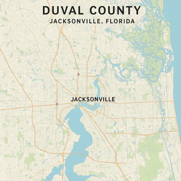
Ever stared at a map of Florida and thought, “Wait, how is Jacksonville this huge?” You’re not alone. Covering nearly 900 square miles, Jacksonville is the largest city by land area in the continental United States — a fact that often leaves newcomers scratching their heads and locals chuckling. But what’s the real story behind this sprawling giant? Is it just about geography, or is there a deeper tale involving politics, history, and some bold decisions?
In this deep dive, we’ll unravel the fascinating reasons why Jacksonville’s city limits stretch so far and wide. From the game-changing 1968 city-county consolidation that merged Jacksonville with Duval County, to the natural boundaries shaped by the St. Johns River and Atlantic coastline, we’ll explore how history, economics, and geography combined to create a city unlike any other. Plus, we’ll take you on a tour of the city’s diverse neighborhoods, explain how the sprawling size impacts daily life, and reveal how Jacksonville balances growth with its abundant green spaces.
Curious about how Jacksonville stacks up against other major cities? Or how the Jaguars and military bases fit into this massive puzzle? Stick around — the answers might surprise you!
Key Takeaways
- Jacksonville’s massive size is mainly due to the 1968 consolidation of the city and Duval County, creating a unified government and sprawling city limits.
- The city covers nearly 900 square miles, making it the largest city by land area in the continental U.S., but with a relatively low population density.
- The St. Johns River and Atlantic coastline play key roles in shaping Jacksonville’s geography and economy.
- Jacksonville is a patchwork of distinct neighborhoods, from historic districts like Riverside to beach communities and rural preserves.
- The city’s size influences everything from transportation challenges to its robust military presence and economic hubs like JAXPORT.
- Despite its vastness, Jacksonville boasts the largest urban park system in the country, offering residents plenty of outdoor space to explore.
Ready to uncover the full story behind Jacksonville’s impressive footprint? Let’s dive in!
Welcome to Jax Facts™, your ultimate insider guide to the Bold New City of the South! We’ve lived through the humidity, cheered through the “Duuuval” chants at EverBank Stadium, and spent way too much time driving from one side of town to the other. If you’ve ever looked at a map and wondered why our city limits seem to go on forever, you aren’t alone. We’re diving deep into the “why” behind our massive footprint.
Table of Contents
- ⚡️ Quick Tips and Facts: Jacksonville at a Glance
- 📜 The Great Consolidation of 1968: How Jax Swallowed Duval County
- 🗺️ Land Area vs. Population: Understanding the 840 Square Mile Beast
- 🌊 Geography and the St. Johns River: A City Defined by Water
- 🏘️ Exploring the Districts: From Urban Core to the Beaches
- 1. Riverside and Avondale: Historic Charm and Hipster Vibes
- 2. San Marco: A Slice of Italy in North Florida
- 3. The Beaches: Atlantic, Neptune, and Jax Beach
- 4. The Northside: Nature Preserves and the Airport
- 5. The Westside: Equestrian Life and Naval History
- 6. Mandarin: Ancient Oaks and River Views
- 7. Southside: The Modern Hub of Commerce and Shopping
- 🏗️ The Economic Engine: Logistics, Navy Bases, and JAXPORT
- 🗳️ One City, One Government: The Efficiency of a Unified System
- 🐆 DUUUVAL! How the Jaguars and Sports Culture Define Our Scale
- ✈️ Getting Around the Giant: Infrastructure, I-95, and JTA
- 🌳 Parks and Recreation: The Largest Urban Park System in the US
- 🎓 Education and Innovation in a Sprawling Metropolis
- 🌟 Notable People Who Call This Massive City Home
- 🤝 Sister Cities and Global Reach
- 💡 Conclusion
- 🔗 Recommended Links
- ❓ FAQ: Everything You Still Want to Know About Jax
- 📚 Reference Links
⚡️ Quick Tips and Facts: Jacksonville at a Glance
Welcome to the sprawling metropolis that is Jacksonville, Florida! If you’ve ever wondered why is Jacksonville so big, you’re in the right place. We’re talking about a city that covers roughly 874 square miles—yes, that’s bigger than New York City, Chicago, and Philadelphia combined! (Check out our detailed Jacksonville size comparison for a mind-blowing perspective.)
Here are some quick facts to get you started:
| Fact | Detail |
|---|---|
| Land Area | ~874 square miles (2,264.84 km²) |
| Population (2024 est.) | ~1,009,833 residents |
| Population Density | ~1,270 people per square mile (low!) |
| City-County Consolidation | 1968, merged Jacksonville & Duval County |
| Major Waterway | St. Johns River (flows north!) |
| Largest Urban Park System | Over 80,000 acres of parks & preserves |
| Military Presence | NAS Jacksonville, Naval Station Mayport |
| Major Port | JAXPORT, Florida’s largest seaport by volume |
✅ Why does this matter? Because Jacksonville’s size isn’t just a trivia fact—it shapes everything from your commute to your weekend beach trips. It’s a city of neighborhoods, nature preserves, and sprawling suburbs all rolled into one.
❓ Curious about how all this came to be? Keep reading—we’ll unravel the history, geography, and politics behind this giant city.
📜 The Great Consolidation of 1968: How Jax Swallowed Duval County
If you think Jacksonville’s size just happened by accident, think again. The 1968 city-county consolidation is the secret sauce behind why Jacksonville sprawls across nearly 900 square miles today.
The Corruption and Crisis that Led to Change
Back in the 1960s, Jacksonville was facing some serious challenges:
- Government corruption scandals were rocking the city.
- The tax base was shrinking as people moved to suburbs outside city limits.
- Fragmented governance between city and county made services inefficient.
The result? A bold plan to merge Jacksonville city government with Duval County to create a unified government that could streamline services and stabilize finances.
Hans Tanzler and the Vision for a Unified City
Mayor Hans Tanzler championed the consolidation, envisioning a city that could:
- Provide better public services across a larger area.
- Attract businesses and development with a unified economic strategy.
- Reduce bureaucratic overlap and corruption.
The consolidation instantly expanded Jacksonville’s borders to include almost all of Duval County, making it the largest city by land area in the continental US. The population jumped by over 160% overnight!
🗺️ Land Area vs. Population: Understanding the 840 Square Mile Beast
Jacksonville’s size is a tale of land area vs. population density. While it’s huge geographically, it’s surprisingly low-density compared to other big cities.
Jacksonville vs. The World: Comparing Land Mass to NYC and Miami
| City | Land Area (sq mi) | Population (2024 est.) | Population Density (per sq mi) |
|---|---|---|---|
| Jacksonville | 874 | 1,009,833 | 1,270 |
| New York City | 302.6 | 8,500,000+ | 28,000+ |
| Miami | 56.1 | 470,000+ | 8,000+ |
Jacksonville’s low density means you’ll find plenty of green space, sprawling neighborhoods, and yes, lots of driving.
The “Largest City in the Contiguous US” Title Explained
Jacksonville’s claim to fame isn’t just bragging rights. It’s the largest city by land area in the continental United States, a title it holds thanks to the 1968 consolidation and its sprawling geography.
But here’s the kicker: the urban core downtown is relatively small and underdeveloped compared to cities like Miami or Atlanta. This creates a unique dynamic where the city feels more like a collection of small towns than one dense metropolis.
🌊 Geography and the St. Johns River: A City Defined by Water
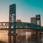
Jacksonville’s geography is a major player in its size story. The St. Johns River, which flows north (yes, north!), slices right through the city, creating natural boundaries and shaping development.
The River that Flows North
Most rivers flow south, but the St. Johns River is a quirky exception. It’s the longest river in Florida and a key reason Jacksonville became a port city.
- The river’s wide, navigable channel supports JAXPORT, Florida’s largest seaport by cargo volume.
- Waterfront neighborhoods like San Marco and Riverside owe their charm to river views and access.
The Intracoastal Waterway and Our Coastal Identity
Jacksonville also hugs the Atlantic Ocean, with the Intracoastal Waterway running parallel to the coast. This adds miles of beaches and waterways that extend the city’s footprint eastward.
- The beaches (Atlantic, Neptune, Jax Beach) are a beloved escape for locals.
- The waterway supports boating, fishing, and tourism industries.
🏘️ Exploring the Districts: From Urban Core to the Beaches
Jacksonville is not one-size-fits-all. It’s a patchwork of distinct neighborhoods and districts, each with its own vibe and history.
1. Riverside and Avondale: Historic Charm and Hipster Vibes
- Known for early 20th-century architecture, tree-lined streets, and artsy shops.
- Home to the Cummer Museum of Art & Gardens and a lively dining scene.
- A favorite for young professionals and creatives.
2. San Marco: A Slice of Italy in North Florida
- Named after Venice’s San Marco Square, this district boasts Mediterranean Revival architecture.
- The San Marco Theatre and plazas create a cozy, walkable downtown feel.
- Great for boutique shopping and upscale dining.
3. The Beaches: Atlantic, Neptune, and Jax Beach
- Miles of sandy coastline perfect for surfing, sunbathing, and festivals.
- Vibrant nightlife and seafood shacks line the shore.
- Popular spots include Jacksonville Beach Pier and Seawalk Pavilion.
4. The Northside: Nature Preserves and the Airport
- Home to Jacksonville International Airport and large tracts of undeveloped land.
- Includes Timucuan Ecological and Historic Preserve, a vast natural area with hiking and kayaking.
- Less dense, more rural feel.
5. The Westside: Equestrian Life and Naval History
- Known for horse farms and the Naval Air Station Jacksonville.
- Mix of suburban neighborhoods and industrial zones.
- A quieter part of town with hidden gems.
6. Mandarin: Ancient Oaks and River Views
- Historic district with oak-lined streets and riverfront estates.
- Popular for boating and fishing on the St. Johns River.
- A peaceful, upscale residential area.
7. Southside: The Modern Hub of Commerce and Shopping
- Home to the St. Johns Town Center, a massive outdoor mall.
- Business parks, hospitals, and residential communities.
- Fast-growing and highly developed.
🏗️ The Economic Engine: Logistics, Navy Bases, and JAXPORT
Jacksonville’s size isn’t just about geography—it’s also about economic muscle.
Why Fortune 500 Companies Love Our Massive Borders
- Jacksonville hosts headquarters for CSX Corporation, FIS, and Fidelity National Financial.
- The city’s vast land area allows for sprawling logistics hubs and industrial parks.
- Proximity to major highways like I-95 and I-10 makes it a transportation nexus.
The Military Presence: NAS Jax and Mayport
- Naval Air Station Jacksonville and Naval Station Mayport are major employers.
- The military presence contributes to economic stability and population growth.
- These bases also influence city infrastructure and community programs.
🗳️ One City, One Government: The Efficiency of a Unified System
Jacksonville’s city-county consolidation means you have one government overseeing a huge area.
How Consolidation Impacts Your Taxes and Services
- Unified government means one tax rate across most of Duval County.
- Services like police, fire, and sanitation are managed citywide.
- Some smaller municipalities (e.g., Baldwin) remain independent but are exceptions.
The Role of the Mayor and City Council in a Giant City
- The Mayor of Jacksonville oversees a massive budget and diverse departments.
- The City Council has representatives from districts spanning urban to rural areas.
- Balancing the needs of such a sprawling city is a constant challenge.
🐆 DUUUVAL! How the Jaguars and Sports Culture Define Our Scale
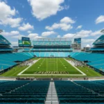
Sports are a big part of Jacksonville’s identity. The Jacksonville Jaguars NFL team puts the city on the national stage.
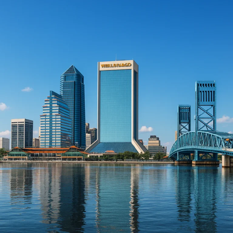
- EverBank Stadium (now TIAA Bank Field) sits downtown but is surrounded by sprawling neighborhoods.
- Jaguars games unite the city’s diverse communities.
- Other sports include minor league baseball, college athletics, and the annual Florida-Georgia football game.
✈️ Getting Around the Giant: Infrastructure, I-95, and JTA
With so much ground to cover, transportation is a hot topic.
- I-95 and I-10 intersect near downtown, making Jacksonville a crossroads for the Southeast.
- The Jacksonville Transportation Authority (JTA) runs buses and the Skyway monorail downtown.
- However, the city’s low density means car dependency is high, leading to long commutes and traffic headaches.
- A Forbes study ranked Jacksonville’s commute among the worst in the country due to sprawl and limited transit options.
🌳 Parks and Recreation: The Largest Urban Park System in the US
Jacksonville boasts the largest urban park system in the United States, with over 80,000 acres of parks, preserves, and green spaces.
- Highlights include Timucuan Preserve, Hanna Park, and Memorial Park downtown.
- These spaces offer hiking, kayaking, fishing, and wildlife viewing.
- The abundance of nature is a direct result of Jacksonville’s vast land area.
🎓 Education and Innovation in a Sprawling Metropolis
Education in Jacksonville reflects its size and diversity.
- The Duval County Public Schools system is one of the largest in Florida.
- Home to universities like the University of North Florida (UNF) and Jacksonville University.
- Growing tech and healthcare sectors fuel innovation hubs and workforce development.
For more on education in Jacksonville, check out our Jacksonville Education section.
🌟 Notable People Who Call This Massive City Home
Jacksonville has produced or attracted a variety of famous folks, including:
- Terry Bradshaw – NFL Hall of Fame quarterback
- Pat Boone – Singer and actor
- Elijah Hood – NFL running back
- Tia and Tamera Mowry – Actress twins from the ’90s sitcom Sister, Sister
- Shaquille O’Neal – NBA legend (grew up nearby)
Their stories reflect the city’s diverse culture and opportunities.
🤝 Sister Cities and Global Reach
Jacksonville maintains sister city relationships that promote cultural and economic exchange:
| Sister City | Country | Established |
|---|---|---|
| Nassau | Bahamas | 1990 |
| São Vicente | Cape Verde | 1984 |
| Taichung | Taiwan | 1980 |
| Valladolid | Spain | 1989 |
These partnerships highlight Jacksonville’s global connections despite its sprawling, local feel.
Before we wrap up, we have to mention the insightful video that dives into Jacksonville’s paradox: a city that’s massive on paper but fragmented in practice. It highlights how the 1968 consolidation created a sprawling metropolis with a small urban core, leading to car dependency and sprawling suburbs. The video also points out Jacksonville’s rapid population growth and the challenges of densification.
It’s a must-watch for anyone fascinated by why Jacksonville is so big and how it functions today.
Ready for the conclusion? We’ll tie it all together next!
Conclusion

So, why is Jacksonville so big? The answer is a fascinating blend of historical consolidation, geographic quirks, and economic strategy. The 1968 city-county consolidation was the game-changer, merging Jacksonville with Duval County and instantly creating a city that sprawls across nearly 900 square miles. This bold move was driven by a desire to streamline government, fight corruption, and foster economic growth.
But size isn’t just about land—it’s about how that land is used. Jacksonville’s low population density, vast natural preserves, and multiple distinct neighborhoods give it a unique character unlike any other major U.S. city. The St. Johns River and Atlantic coastline add to the city’s charm and economic importance, especially with the presence of JAXPORT and major military installations.
The sprawling geography creates challenges, like car dependency and infrastructure demands, but also offers incredible opportunities for outdoor recreation, diverse communities, and economic development. Whether you’re cruising down I-95, enjoying a Jaguars game, or exploring the beaches, Jacksonville’s size is part of what makes it truly special.
In short: Jacksonville’s massive size is no accident—it’s a deliberate, complex story of governance, geography, and growth that continues to shape the city’s future. And now, you’re in on the secret!
Recommended Links
Looking to dive deeper or explore Jacksonville-themed products? Here are some great resources and books to expand your knowledge and love for the Bold New City of the South:
-
Jacksonville Size Comparison Book:
Jacksonville: The Largest City in the Continental US on Amazon -
Jaguars Gear and Apparel:
-
Outdoor and Recreation Gear for Exploring Jacksonville’s Parks:
-
Books on Florida History and Urban Development:
❓ FAQ: Everything You Still Want to Know About Jax

Why does Jacksonville have such a large land area compared to other cities?
Jacksonville’s large land area is primarily due to the 1968 city-county consolidation, which merged the city government with Duval County. This expanded the city limits to cover almost the entire county, including urban, suburban, and rural areas. Unlike other cities that have smaller, more densely populated boundaries, Jacksonville’s borders include vast natural preserves, residential neighborhoods, and industrial zones, resulting in a sprawling footprint.
How did Jacksonville’s city-county consolidation affect its size?
The consolidation was a pivotal event that increased Jacksonville’s land area by over 500 square miles overnight. It unified governance, reduced bureaucratic overlap, and allowed for coordinated urban planning. This move was designed to combat corruption and improve public services, but it also meant that Jacksonville officially became the largest city by land area in the contiguous United States. The consolidation also brought most of Duval County’s population under one municipal government, boosting Jacksonville’s population and political influence.
What historical factors contributed to Jacksonville’s expansion?
Several historical factors played a role:
- Strategic location on the St. Johns River and Atlantic coast, making it a key port city.
- Development of JAXPORT, Florida’s largest seaport by volume.
- Growth of military installations like Naval Air Station Jacksonville and Naval Station Mayport.
- Suburbanization trends in the mid-20th century, with residents moving to surrounding areas.
- The 1968 consolidation that merged city and county governments.
All these factors combined to create a city that is both economically diverse and geographically expansive.
How does Jacksonville’s size impact its population and economy?
Jacksonville’s size means it has a lower population density compared to other major cities, which affects transportation, infrastructure, and urban planning. The sprawling geography supports a diverse economy including logistics, finance, healthcare, military, and tourism. However, the low density also leads to car dependency and traffic congestion. On the positive side, the large land area allows for extensive parks, natural preserves, and varied neighborhoods, which enhance quality of life and attract residents and businesses.
How does Jacksonville’s geography influence its development?
The Role of the St. Johns River and Coastline
The St. Johns River is a vital artery for commerce and recreation, shaping the city’s layout and economy. The river’s northward flow and the Atlantic coastline create natural boundaries and opportunities for port activities, waterfront living, and tourism.
Impact of Natural Preserves and Parks
Jacksonville’s vast green spaces, including the Timucuan Preserve and numerous parks, limit urban sprawl in some areas but also contribute to the city’s low density and unique character.
What challenges does Jacksonville face due to its size?
- Transportation: Heavy reliance on cars leads to traffic and long commutes.
- Infrastructure: Maintaining roads, utilities, and services across such a large area is costly and complex.
- Urban Planning: Balancing growth with preservation of natural areas requires careful policy.
- Service Delivery: Ensuring equitable access to public services in both urban and rural parts of the city.
📚 Reference Links
For further verification and exploration, here are some reputable sources and official pages:
- Jacksonville Wikipedia – Comprehensive overview of Jacksonville’s history, geography, and demographics.
- City of Jacksonville Official Website – Government resources and city services.
- JAXPORT Official Site – Information on Florida’s largest seaport.
- Naval Air Station Jacksonville – Military presence and community info.
- Jacksonville Jaguars Official Site – Sports and community engagement.
- Jacksonville Transportation Authority (JTA) – Public transit and infrastructure.
- Jacksonville is a large city in Florida – Facebook – Community discussion and insights on Jacksonville’s size.
- Jacksonville Facts™ – Jacksonville Facts Category – Dive deeper into Jacksonville trivia and history.
- Jacksonville Education – Learn about schools and universities.
- Jacksonville Demographics – Population and census data.
- Jacksonville Culture – Arts, sports, and lifestyle.
- Jacksonville Beaches – Explore the coastal side of Jax.
Thanks for sticking with us through this deep dive into why Jacksonville is so big! Whether you’re a lifelong resident or a curious visitor, we hope you now see the Bold New City of the South with fresh eyes—and maybe a little more pride. 🐆🌴