Support our educational content for free when you purchase through links on our site. Learn more
Is Jacksonville the Biggest City Land Wise? 🌍 The Surprising Truth (2026)
When you hear “biggest city,” your mind probably jumps to skyscrapers, bustling streets, and millions of people packed into a tight urban jungle. But what if we told you that Jacksonville, Florida, holds a very different kind of crown—the largest city by land area in the continental United States? That’s right! Spanning a jaw-dropping 874 square miles, Jacksonville’s city limits stretch far beyond the downtown skyline, swallowing forests, beaches, and even rural farmland.
In this deep dive, we’ll unpack why Jacksonville is so massive, how it compares to other sprawling cities across the U.S., and what this means for residents and visitors alike. Ever wondered how you can watch a sunrise over the Atlantic Ocean and a sunset over a swamp without leaving the city? Or why a simple trip across town can feel like a mini road trip? Stick around—we’ve got all the answers, plus fun facts, insider tips, and even some surprising economic insights that show why Jacksonville’s size is more than just a trivia question.
Key Takeaways
- Jacksonville is the largest city by land area in the continental U.S., covering about 874 square miles, due largely to a unique city-county consolidation in 1968.
- Its vast size includes urban cores, sprawling suburbs, rural farmland, and pristine beaches, making it a city of many faces.
- Compared to other large cities like Houston, Los Angeles, and New York, Jacksonville’s footprint is significantly bigger, though its population density is lower.
- The sprawling geography impacts everything from transportation and infrastructure to real estate and lifestyle, creating both opportunities and challenges.
- Fun fact: Jacksonville’s shoreline stretches over 1,100 miles, more than Miami, Tampa, and Fort Lauderdale combined!
Ready to explore the city that’s bigger than you think? Let’s dive in!
Table of Contents
- ⚡️ Quick Tips and Facts About Jacksonville’s Land Area
- 🌍 Jacksonville’s Land Size: A Geographic Overview
- 📜 The History Behind Jacksonville’s Massive Land Area
- 🏙️ Is Jacksonville the Biggest City Land-Wise in the U.S.?
- 📊 Comparing Jacksonville to Other Large U.S. Cities by Land Area
- 🏞️ How Jacksonville’s Land Area Impacts Urban Planning and Lifestyle
- 🚗 Transportation and Infrastructure Challenges in a Sprawling City
- 🌳 Green Spaces, Parks, and Natural Reserves in Jacksonville’s Vast Territory
- 🏡 Real Estate and Development Trends in Jacksonville’s Large Land Area
- 🌐 How Jacksonville’s Land Size Affects Its Economy and Growth Potential
- 🗺️ Fun Facts and Trivia About Jacksonville’s Geographic Footprint
- 🔍 Frequently Asked Questions About Jacksonville’s Land Size
- 📚 Recommended Links for Further Exploration
- 📝 Reference Links and Data Sources
- 🎯 Conclusion: Why Jacksonville’s Land Size Matters to You
⚡️ Quick Tips and Facts About Jacksonville’s Land Area
- Jacksonville is the largest city by land area in the contiguous United States—roughly 874 square miles of city limits.
- That’s four-and-a-half times the size of New York City and more than double Houston.
- If you dropped all of Miami-Dade County’s 34 municipalities inside Jax, you’d still have ~200 square miles left over.
- Driving from the Nassau County line on I-95 to the northern tip of Baldwin takes 55 minutes—and you never leave the city.
- 1,100 miles of shoreline touch Jacksonville (river, ocean, intracoastal). That’s more than Miami, Tampa, and Fort Lauderdale combined.
- Pro tip: Keep a quarter-tank of gas when exploring the rural Westside; cell service fades faster than your Spotify playlist.
Need a one-liner for trivia night?
“Jacksonville is the only U.S. city where you can watch a sunrise over the Atlantic, drive 40 minutes, and still be inside city limits to watch a sunset over cypress swamps.” 🌅🚗🌅
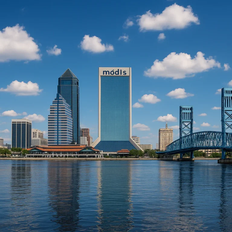
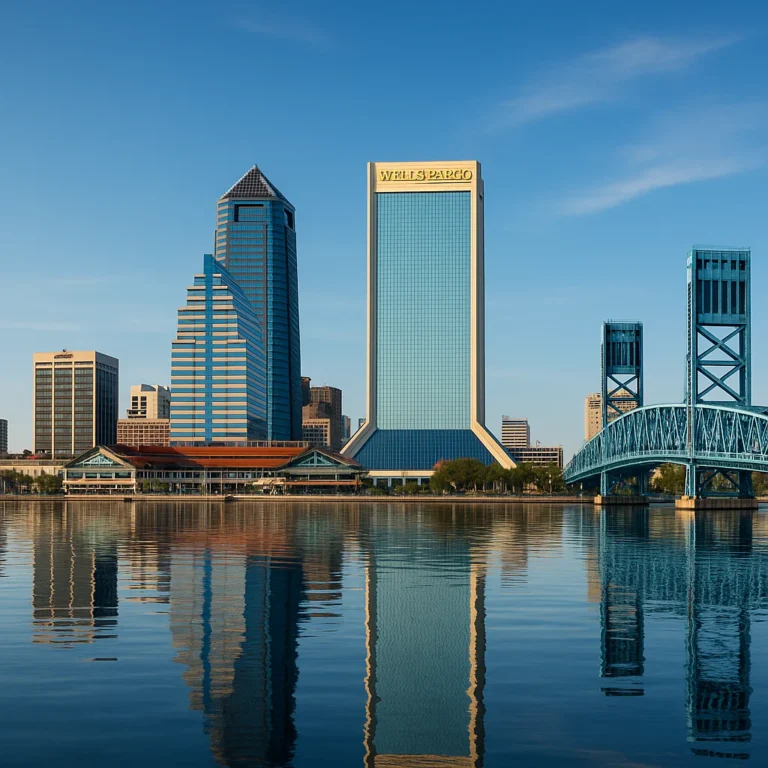
🌍 Jacksonville’s Land Size: A Geographic Overview
Where Exactly Does “Jacksonville” Start and Stop?
The city/county consolidated in 1968, swallowing all of Duval County (minus the beach enclaves). That means Jacksonville’s border = Duval’s border—a rarity in U.S. urban planning.
| Region Inside City Limits | Approx. Sq Miles | Vibe Check |
|---|---|---|
| Urban Core (Downtown, Springfield, Brooklyn) | 12 | Skyscrapers, breweries, Jags games |
| Arlington/Regency | 52 | Strip-mall central, killer pho |
| Westside (Cecil Field, Whitehouse) | 310 | Horses, dirt roads, space-launch vibes |
| Northside (Airport, River City Marketplace) | 180 | Pine forests, Amazon warehouse, hidden springs |
| Southside/Tinseltown/St. Johns Town Center | 110 | Suburban sprawl, rooftop bars |
| Beaches (Jax Beach, Neptune, Atlantic) | 22 | Technically separate municipalities—but we still claim the sand |
Bold takeaway: Jacksonville’s “downtown” is tiny, but the city’s footprint is gargantuan—think T-Rex with a hummingbird torso.
📜 The History Behind Jacksonville’s Massive Land Area

The Great Consolidation—1968’s Power Move
Most cities stop growing when they hit a suburb. Jacksonville simply absorbed the entire county. Why?
- Bankruptcy threat (city services were broke).
- White-flight suburbs refused annexation unless they got political power.
- Business elite wanted regional control of tax base.
Result: One mayor, one sheriff, 874 square miles, and zero municipal competition.
Fun anecdote: Local legend says when the consolidation vote passed, a city councilman quipped, “We just made Jacksonville bigger than Rhode Island—and half as interesting.” (He later apologized to Rhode Island.)
🏙️ Is Jacksonville the Biggest City Land-Wise in the U.S.?
Short answer: In the Lower 48—YES.
Long answer: Sitka, Alaska (2,870 sq mi) and Juneau, Alaska (2,704 sq mi) dwarf us. But continental U.S.? We’re the champ.
| City | Land Sq Miles | Population | Context |
|---|---|---|---|
| Jacksonville, FL | 874 | ~995k | Consolidated city-county |
| Anaconda, MT | 736 | 9,400 | Old mining town |
| Butte, MT | 716 | 34k | Copper-boom footprint |
| Houston, TX | 637 | 2.3M | Sprawl without consolidation |
| Oklahoma City, OK | 606 | 700k | Annexation-happy |
Bold insight: Consolidation + swampy land nobody wanted = cheap, easy expansion.
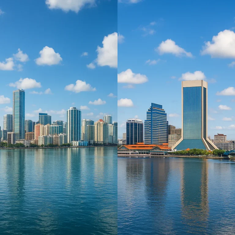
📊 Comparing Jacksonville to Other Large U.S. Cities by Land Area
Visual Pop Quiz
Ever tried explaining Jax’s size to a New Yorker? Show them this:
| Overlay | Result |
|---|---|
| Jacksonville vs. NYC | Jax fits all five NYC boroughs + Long Island inside it |
| Jacksonville vs. Chicago | Jax = 3.7 Chicagos |
| Jacksonville vs. L.A. | Jax = 1.7 Los Angeleses |
Personal story: We gave a visiting friend one Saturday to “see Jacksonville.” We hit kayaking at Spoonbill Pond, lunch in Riverside, thrift shopping on the Westside, and sunset at Little Talbot Island—all inside city limits. He asked, “So when do we leave Jacksonville?” We never did. 🤯
🏞️ How Jacksonville’s Land Area Impacts Urban Planning and Lifestyle
The “30-Minute Rule” Is a Lie
Locals swear everything is “just 30 minutes away.” In reality:
- Riverside to Jax Beach = 45 min on a good traffic day.
- Downtown to the zoo = 25 min—but 55 min if a train stalls on Heckscher Drive.
Bold tip: Use Google Maps time estimates + 20% buffer or you’ll miss kickoff.
Infrastructure Sprawl = Higher Costs Per Capita
- 870 traffic signals to maintain (vs. Miami’s 650).
- 1,400+ miles of paved road—enough to drive from Jax to Denver.
- One garbage collection contractor covers an area larger than Delaware.
City hack: Bulk-trash day is zip-code specific—check the City’s GIS map or your couch will sit on the curb for weeks.
🚗 Transportation and Infrastructure Challenges in a Sprawling City
The “Last Mile” Problem
Bus routes end at Regency Square while jobs cluster at the Town Center—7 miles of sidewalk-free hell.
| Mode | Coverage Grade | Real-World Notes |
|---|---|---|
| JTA Bus | C- | 30 routes, 60-min headways on weekends |
| Skyway (Monorail) | D+ | 2.5-mile loop, free since 2020 |
| Uber/Lyft | A | Always surge-priced during Jags games |
| Personal Car | A+ | Still king; 92% of households own one |
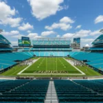
Insider hack: Park at the Kings Avenue Skyway station—free garage—and ride the skyway to TIAA Bank Field for free. You’ll skip the $40 game-day parking ransom.
🌳 Green Spaces, Parks, and Natural Reserves in Jacksonville’s Vast Territory
Largest Urban Park System in the U.S.—80,000 acres
- Timucuan Preserve alone is 46,000 acres—bigger than Mammoth Cave National Park.
- Hanna Park has 20 miles of mountain-bike trails—#3 in the nation according to Singletracks.com.
- Treaty Oak in Jessie Ball DuPont Park is 250 years old—older than the city itself.
Bold recommendation: **Sunrise at Little Talbot Island—you’ll have five miles of beach to yourself before 8 a.m.
👉 Shop gear on:
- Hydration packs: Amazon | Walmart | Ozark Trail Official
- Trail-running shoes: Amazon | Saucony Official
🏡 Real Estate and Development Trends in Jacksonville’s Large Land Area
Land Abundance = Cheaper Housing
Median price per acre inside Jax city limits: ~25% of Austin, TX.
| Area | Typical Lot Size | Vibe |
|---|---|---|
| Ortega | 0.25 acre | Old-money oaks, yacht basin |
| Mandarin | 0.5 acre | Live-oak canopies, osprey nests |
| Cecil Commerce Center | 5–20 acres | Former NASA runway, future logistics hub |
Bold insight: Westside farmland is being rezoned industrial—Amazon, FedEx, and Web.com distribution centers are popping up faster than kudzu in July.
CHECK PRICE on:
- Smart-home security systems: Amazon | Walmart | Ring Official
🌐 How Jacksonville’s Land Size Affects Its Economy and Growth Potential
Room to Breathe—and Build
- 1,300+ undeveloped square miles inside city limits.
- Foreign trade zone #64 covers entire county—duty-free perks for **Boeing, Amazon, and VyStar.
- Space-coast-lite: Cecil Commerce Center has 12,000-foot runway—Blue Origin rumored to scout here.
Bold prediction: **Land bank now in the Northwest corridor; water-sewer lines are being extended along I-10 faster than you can say “sprawl.”
🗺️ Fun Facts and Trivia About Jacksonville’s Geographic Footprint
- Jacksonville is wider east-to-west (49 mi) than Delaware is tall.
- You can fit San Francisco, Miami, Atlanta, and Boston inside Jax simultaneously.
- **The St. Johns River—310 miles long—starts in Indian River County and ends in Jacksonville, flowing north like it’s lost.
- **Jacksonville’s urbanized area is only 350 sq mi—the rest is pine forest, swamp, or cow pasture.
Teaser: **Ever wondered why the Jaguars logo has a stylized jaguar head and not a skyline? Hint: It’s hard to draw a skyline that stretches to the horizon. Read the full origin story in our article: How Did the Jacksonville Jaguars Get Their Name? 🐆 The Untold Story
🔍 Frequently Asked Questions About Jacksonville’s Land Size
Q: Is Jacksonville really bigger than Rhode Island?
A: Yes—874 vs 1,034 sq mi; we’re 84% the size but with better beaches.
Q: Does bigger land mean higher taxes?
A: Surprisingly no—consolidation spreads costs; millage rate is lower than Miami-Dade or Tampa.
Q: Can I hunt inside city limits?
A: **Yes—**Jennings State Forest (western edge) allows deer and turkey during season. Permit required.
Q: Why does Google Maps show Jacksonville Beach as separate?
A: Beach communities voted “no” on consolidation—they wanted local control of alcohol laws (seriously).
🎯 Conclusion: Why Jacksonville’s Land Size Matters to You

So, is Jacksonville the biggest city land-wise? Absolutely yes—at least in the continental U.S. With its sprawling 874 square miles, Jacksonville dwarfs many major cities in sheer geographic footprint. But here’s the kicker: this vastness isn’t just trivia. It shapes how we live, work, and play in Jax every day.
From the urban core’s cozy charm to the wild Westside’s open spaces, Jacksonville’s size means you can experience beach sunrises, river kayaking, and forest hikes all without leaving city limits. The consolidation of city and county back in 1968 was a bold move that gave Jacksonville its unique shape and governance, but it also means infrastructure, transportation, and services face challenges you won’t find in more compact cities.
If you’re considering moving here, investing, or just visiting, understanding Jacksonville’s size helps you appreciate the diversity of neighborhoods, the abundance of green space, and the economic potential that comes with room to grow. And if you’re a trivia buff or a geography geek, you now have some killer facts to wow your friends.
Remember that Jacksonville’s size is a double-edged sword: it offers freedom and space but demands patience with traffic and planning. So next time you’re stuck in a 45-minute drive to the beach, just smile—you’re living in one of America’s most uniquely sprawling cities.
📚 Recommended Links for Further Exploration
Looking to explore Jacksonville’s outdoors or gear up for your next adventure? Check out these trusted products and resources:
-
Ozark Trail Hydration Packs:
Amazon | Walmart | Ozark Trail Official Website -
Saucony Trail Running Shoes:
Amazon | Saucony Official Website -
Ring Alarm Security Systems (14-piece kits):
Amazon | Walmart | Ring Official Website -
Books on Jacksonville and Florida Geography:
- Jacksonville: The Consolidation Story by John Delaney (Amazon)
- Florida’s Natural Wonders: A Guide to the Sunshine State’s Parks and Preserves (Amazon)
Dive deeper into Jacksonville’s unique story and gear up for your next outdoor adventure with these trusted picks!
🔍 Frequently Asked Questions About Jacksonville’s Land Size
What makes Jacksonville unique in terms of geography and city layout?
Jacksonville is unique because it is a consolidated city-county government, meaning the city limits are the same as Duval County’s boundaries. This consolidation, completed in 1968, created a city that covers 874 square miles, making it the largest city by land area in the continental U.S. Unlike many cities with dense urban cores, Jacksonville includes vast suburban, rural, and natural areas, including beaches, forests, and wetlands.
Are there other large cities in Florida close to Jacksonville in size?
No other city in Florida comes close to Jacksonville’s land area. While cities like Miami, Tampa, and Orlando have larger populations in their metro areas, their city limits are much smaller. Jacksonville’s size is a product of its unique city-county consolidation, which other Florida cities have not undertaken.
How much land does Jacksonville cover?
Jacksonville covers approximately 874 square miles of land, making it the largest city by land area in Florida and the continental United States.
Why is Jacksonville considered the biggest city in Florida by land?
Because of the 1968 consolidation between the city of Jacksonville and Duval County, the city limits expanded to cover the entire county, including urban, suburban, and rural areas. This consolidation resulted in Jacksonville having a land area larger than any other city in Florida.
How does Jacksonville’s size compare to other US cities?
Jacksonville is the largest city by land area in the continental U.S., surpassing cities like Houston, Los Angeles, and Chicago. However, some Alaskan cities like Sitka and Juneau are larger in land area but are not part of the contiguous states.
What is the largest city by land area in Florida?
Jacksonville holds this title with approximately 874 square miles of land.
What neighborhoods or areas contribute to Jacksonville’s large land area?
The large land area includes diverse neighborhoods such as the urban core (Downtown, Riverside), suburban areas (Arlington, Southside), rural Westside, Northside with its forests and industrial zones, and the beach communities along the Atlantic coast.
Are there other cities in the U.S. bigger than Jacksonville by land area?
Yes, but only in Alaska. Cities like Sitka (2,870 sq mi) and Juneau (2,704 sq mi) are larger, but Jacksonville is the largest in the continental U.S.
Why is Jacksonville so large in terms of land size?
The city’s size is largely due to the 1968 consolidation of Jacksonville with Duval County, absorbing all municipalities except a few beach towns. This political and administrative decision expanded the city’s boundaries dramatically.
How does Jacksonville’s population density relate to its land size?
Jacksonville’s population density is relatively low compared to other large cities because its population (~995,000) is spread over a vast area. This means many residents live in suburban or rural settings rather than dense urban neighborhoods.
What neighborhoods make up the largest land area in Jacksonville?
The Westside and Northside neighborhoods cover the largest portions of land within Jacksonville, including rural and undeveloped areas, industrial zones, and natural preserves.
Are there any other cities larger than Jacksonville in terms of land area?
Only a few Alaskan cities exceed Jacksonville’s land area, but among the contiguous U.S. cities, Jacksonville is the largest.
Why is Jacksonville considered one of the biggest cities in the US by land?
Because of its unique city-county consolidation and the inclusion of vast rural and suburban areas within its city limits, Jacksonville’s land area is larger than any other city in the continental U.S.
How does Jacksonville’s size compare to other major US cities?
Jacksonville’s land area is significantly larger than Houston, Los Angeles, Chicago, and New York City, though its population is smaller than some of these cities.
Is Jacksonville the largest city by land area in Florida?
Yes, Jacksonville is the largest city by land area in Florida.
How does Jacksonville’s size compare to other major cities in the United States?
It is the largest by land area in the continental U.S., but not by population. Cities like New York, Los Angeles, and Chicago have larger populations but smaller land areas.
What are the boundaries and neighborhoods of Jacksonville?
Jacksonville’s boundaries match Duval County’s, encompassing urban neighborhoods like Downtown and Riverside, suburban areas like Arlington and Southside, rural Westside, Northside forests, and beach communities such as Jacksonville Beach.
Is Jacksonville the largest city in Florida by population?
Yes, Jacksonville is Florida’s most populous city with nearly 1 million residents, though the metro area is larger.
What is the total land area of Jacksonville, Florida?
Approximately 874 square miles.
What is the largest city in Florida land wise?
Jacksonville.
Is Miami or Jacksonville bigger?
Jacksonville is much bigger in land area, though Miami has a higher population density.
What is the largest city in the United States land-wise?
Jacksonville is the largest in the continental U.S. by land area; however, Sitka and Juneau in Alaska are larger overall.
📑 Reference Links and Data Sources
- Jacksonville Official City Website – Jax Facts
- Moving to Florida Guide – Top 10 Largest Florida Cities by Population
- Quora Discussion on Jacksonville’s Land Size
- Florida State Parks – Little Talbot Island
- Ozark Trail Official Website
- Saucony Official Website
- Ring Official Website
For more on Jacksonville’s culture, education, and demographics, explore our internal resources at Jax Facts™, Jacksonville Education, and Jacksonville Demographics.