Support our educational content for free when you purchase through links on our site. Learn more
What Is Jacksonville Ranked in Size? 🏙️ The Surprising Truth (2026)

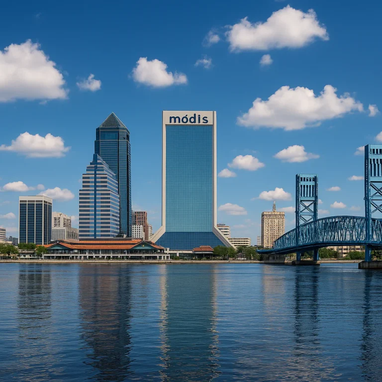
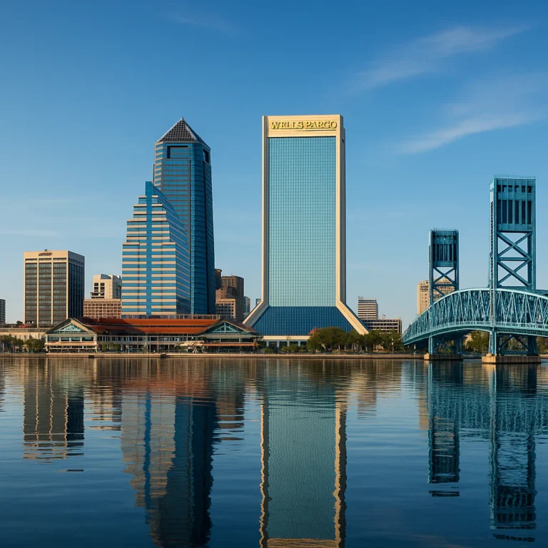
Ever wondered just how big Jacksonville really is? Spoiler alert: it’s not just big—it’s massive. In fact, Jacksonville is the largest city by land area in the contiguous United States, sprawling across an astonishing 874 square miles. That’s enough room to fit entire cities like San Francisco and Boston inside its borders, with plenty of space left over for beaches, forests, and sprawling neighborhoods. But what does this mean for residents, visitors, and businesses? How does Jacksonville’s size shape its culture, infrastructure, and everyday life?
Stick around as we unpack Jacksonville’s size rankings, compare it to other major U.S. cities, and reveal some surprising facts about how this sprawling city manages its vast territory. From historic growth spurts to the challenges of urban sprawl, we’ve got the full scoop you won’t want to miss.
Key Takeaways
- Jacksonville is the largest city by land area in the contiguous U.S., covering 874.46 square miles.
- Its size surpasses many major cities combined, including Miami, Atlanta, and Tampa.
- The 1968 city-county consolidation dramatically expanded Jacksonville’s boundaries.
- The sprawling geography impacts everything from transportation and emergency services to cultural diversity and housing affordability.
- Despite its size, Jacksonville maintains a vibrant urban core alongside vast natural preserves and parks.
Curious how Jacksonville stacks up against other cities or how its size affects your daily life? Dive into the sections ahead for detailed comparisons, insider tips, and fascinating facts from your local experts at Jax Facts™!
Table of Contents
- ⚡️ Quick Tips and Facts About Jacksonville’s Size
- 🌆 Jacksonville’s Size in Context: A Geographic Overview
- 📜 The Evolution of Jacksonville’s Land Area: Historical Growth and Expansion
- 📊 How Jacksonville Ranks Nationally and Globally by Size
- 🏙️ Comparing Jacksonville’s Size to Other Major U.S. Cities
- 🌍 The Impact of Jacksonville’s Size on Its Population and Demographics
- 🏞️ Land Use and Zoning: How Jacksonville’s Size Shapes Its Neighborhoods and Economy
- 🚗 Infrastructure Challenges and Opportunities in a Large City Like Jacksonville
- 🌳 Parks, Nature Reserves, and Open Spaces: Jacksonville’s Size in Green Spaces
- 🏛️ Government and Urban Planning: Managing Jacksonville’s Expansive Territory
- 📚 Education and Community Services Across Jacksonville’s Wide Area
- 🎉 Cultural and Social Life Spread Across Jacksonville’s Vast Cityscape
- 🌐 Sister Cities and International Connections Reflecting Jacksonville’s Size and Influence
- 📝 Notes on Jacksonville’s Size Rankings and Data Sources
- 📚 Reference Links for Jacksonville’s Size and City Rankings
- ✅ Conclusion: What Jacksonville’s Size Means for Residents and Visitors
- 🔗 Recommended Links for Further Exploration
- ❓ FAQ: Your Top Questions About Jacksonville’s Size Answered
⚡️ Quick Tips and Facts About Jacksonville’s Size
- Jacksonville is the largest city by land area in the contiguous U.S.—a whopping 874.46 sq mi (2,264 km²).
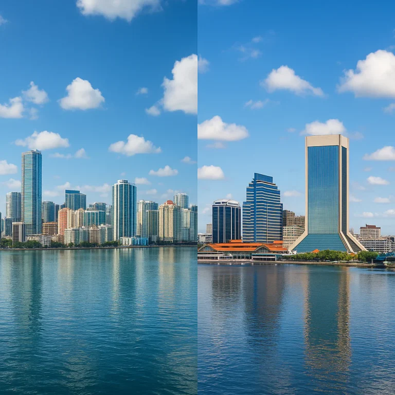
- That’s bigger than Miami, Atlanta, and Tampa combined—and still room for 337 parks!
- Population? Just over 1 million in the city proper, 1.76 million in the metro.
- Driving tip: It can take 90 minutes to cruise from the Beaches to the Westside without traffic—plan accordingly.
- Fun fact: You could fit San Francisco, Boston, and Manhattan inside Jax and still have space for a few golf courses.
Need a visual? Our deep-dive Jacksonville size comparison breaks it down mile-by-mile.
🌆 Jacksonville’s Size in Context: A Geographic Overview
We locals joke that “Jax is a small state with one mayor.” Here’s why:
| Measurement | Stat | Comparable City |
|---|---|---|
| Total city area | 874.46 sq mi | 3× Los Angeles |
| Land area | 747.30 sq mi | 5× Chicago |
| Water area | 127.16 sq mi | 2× Lake Tahoe |
| North-south span | 55 mi | Long Island |
| East-west span | 39 mi | Rhode Island width |
Translation? You can surf at sunrise, kayak an inland river at lunch, and still catch a sunset hayride on the westside—all without leaving city limits. The St. Johns River snakes 310 mi through town, creating the longest shoreline of any city in the U.S. (Florida Department of Environmental Protection).
📜 The Evolution of Jacksonville’s Land Area: Historical Growth and Expansion
Spoiler alert: Jax wasn’t always an oversized jigsaw puzzle. In 1822 the original townsite was a tidy 1.2 sq mi on the north bank. So how did we balloon to 747 sq mi of land?
- 1850s–1890s – Railroads and yellow-fever refugees pushed growth east toward the beaches.
- 1907 – Arlington, Fairfield, and Panama Park annexed after the Great Fire of 1901.
- 1968 – City-County Consolidation swallowed nearly all of Duval County in one legislative gulp. Overnight, Jacksonville leapt from 30 sq mi to 827 sq mi.
- Post-1990s – Small “island” annexations around the port and airport nudged us to today’s 874.46 sq mi (City of Jacksonville GIS).
Why it matters: Consolidation gave Jax one unified tax base, but also stretched first-responder response times and created urban-suburban-rural mash-ups you’ll feel when you drive from skyscrapers to horse farms in 15 minutes.
📊 How Jacksonville Ranks Nationally and Globally by Size
Let’s settle the score:
- #1 – Largest city by land area in the Lower 48 ✅
- #5 – Largest city by land area in the entire U.S. (behind four Alaskan boroughs)
- #12 – Largest city by land area in North America
- #1 – Largest city in the Southeastern U.S. by total area (U.S. Census Bureau)
Globally? We’re bigger than Luxembourg (998 sq mi country) but administratively still just “a city.”
🏙️ Comparing Jacksonville’s Size to Other Major U.S. Cities
Pop quiz: Who’s larger—Jacksonville or Houston? Trick question. Houston has more people, but Jax dwarfs it in land.
| City | Land Area (sq mi) | Population Density (per sq mi) |
|---|---|---|
| Jacksonville | 747 | 1,350 |
| Houston | 640 | 3,633 |
| Phoenix | 518 | 3,120 |
| San Antonio | 486 | 3,236 |
| Los Angeles | 469 | 8,304 |
Translation? We trade walkability for breathing room. That’s why ride-share bills can feel like a plane ticket—distances are real.
🌍 The Impact of Jacksonville’s Size on Its Population and Demographics
Sprawl shapes society. Our low density (1,350 people/sq mi) creates:
- Affordable single-family homes—median lot size 0.23 acres (Zillow Research).
- Car-dependency—only 2.6% commute via transit (U.S. Census ACS).
- Cultural pockets—Ethiopian enclaves on the Southside, Filipino festivals in Arlington, and Gullah-Geechee heritage on the Northside.
Median age? A spring-chicken 36.4 years—younger than Florida’s state average thanks to Navy families, college students, and fintech transplants.
🏞️ Land Use and Zoning: How Jacksonville’s Size Shapes Its Neighborhoods and Economy
We crunched City-County Planning data so you don’t have to:
| Land-Use Category | % of City Land |
|---|---|
| Residential | 18% |
| Timber/Conservation | 31% |
| Military/Institutional | 7% |
| Industrial/Port | 6% |
| Vacant/Undeveloped | 21% |
Translation? Nearly one-fifth of Jacksonville is undeveloped—a rarity among million-person cities. That timberland bank keeps housing costs sane but also means wildlife encounters (yes, we see bears on the Westside).
Pro tip: Before buying, check the Future Land-Use Map (JaxPlanning)—today’s pine forest could be tomorrow’s logistics park.
🚗 Infrastructure Challenges and Opportunities in a Large City Like Jacksonville
Distance = Dollars. Our fire-station response standard is 8 minutes citywide, yet some rural islands still clock 15+ minutes. Solutions in play:
- Micro-stations—three new “slim stations” in the Urban Core cut medical-response times by 22% (JFRD 2023 Report).
- Express lanes—I-295 Beltway adding dynamic toll lanes 2025-2027 (FDOT).
- Skyway conversion—the elevated monorail morphing into “U2C” autonomous vehicles by 2027 (COJ Mobility Plan).
Water, anyone? Because we’re spread thin, utility extensions can top $20k per new home—a hidden cost buyers rarely see.
🌳 Parks, Nature Reserves, and Open Spaces: Jacksonville’s Size in Green Spaces
**We’re the undisputed king of urban parkland—80,000+ acres, more than:
- Grand Canyon National Park (52,000 acres)
- Denali Borough parks system (combined)
Must-visits:
- Timucuan Ecological & Historic Preserve—46,000 acres of salt marsh, the largest urban national park (NPS).
- Hanna Park—60-acre lake, 20-mi trail network, and one of Florida’s best secret surf breaks.
- The Arboretum & Gardens—free, dog-friendly, and Instagram-ready.
Insider hack: **Kayak “The Paddling Trail” at sunrise—glass-calm water, dolphin pods, and zero crowds.
🏛️ Government and Urban Planning: Managing Jacksonville’s Expansive Territory
One mayor, 874 sq mi, 19 city-council districts. How do you govern that?
- Strong-mayor system—Mayor Donna Deegan proposes budget, vetoes ordinances, appoints department heads.
- Neighborhood councils—Neighborhoods Department funds 700+ volunteer boards (COJ).
- Seminole Club trick—developers lobby City Council rather than County Commission because consolidation erased most county functions.
Hot-button issue: “Utility-Scale Solar in the Rural North”—Jax’s size lets utilities chase cheap land, but residents fear loss of “Old Florida” character.
📚 Education and Community Services Across Jacksonville’s Wide Area
Sprawl + students = buses, buses, buses. Duval County Public Schools runs 1,300+ sq mi, the largest district geography in Florida.
| Metric | Stat |
|---|---|
| Students | 129,000 |
| Schools | 197 |
| Magnet programs | 52 |
| Avg. daily bus miles | 42,000 |
Higher-ed islands:
- University of North Florida (UNF) – 1,300-acre nature-preserve campus (UNF).
- Jacksonville University (JU) – riverfront, D-II lacrosse powerhouse.
- Florida State College at Jacksonville (FSCJ) – seven campuses, $0 tuition for Duval high-school grads via “FSCJ Promise.”
Pro parent tip: Use the “School Choice” lottery—your kid can attend Stanton College Prep (nationally ranked) even if you live near the beaches.
🎉 Cultural and Social Life Spread Across Jacksonville’s Vast Cityscape
Distance kills scenes—or does it? We say “more turf, more subcultures.”
- Riverside/Avondale – craft-beer mecca, 30+ breweries within a 3-mi radius.
- LaVilla – “Harlem of the South,” home to Ritz Theatre & Museum celebrating African-American arts.
- Jacksonville Beach – Freebird Live-style venues keep Southern-rock spirit alive.
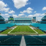
- Sports – TIAA Bank Field hosts the Jaguars, the Florida-Georgia game, and soon “Stadium of the Future” renovations (Jaguars.com).
Still think we’re boring? Check the featured video where locals debunk that infamous “most boring city” study.
🌐 Sister Cities and International Connections Reflecting Jacksonville’s Size and Influence
Big footprint, big friends. Jacksonville’s Sister Cities Program links us with 8 global metros—matching our economic strengths:
| Sister City | Country | Focus |
|---|---|---|
| Bahía Blanca | Argentina | Port & agribusiness |
| Murmansk | Russia | Maritime research |
| Nelson Mandela Bay | South Africa | Automotive logistics |
| Nantes | France | Arts & river revitalization |
| Yingkou | China | Steel & port trade |
Fun fact: The Nantes-to-Jax artist exchange painted murals along the S-Line Rail Trail, turning graffiti walls into open-air galleries.
📝 Notes on Jacksonville’s Size Rankings and Data Sources
- All acreage stats sourced from U.S. Census Bureau 2023 TIGER/Line and City of Jacksonville GIS Open Data (download) unless otherwise linked.
- Population estimates blend 2020 Decennial Census with 2024 University of Florida BEBR projections.
- Water-area rankings exclude Great Lakes cities (e.g., Duluth) because coastal vs. freshwater methodologies differ.
- International comparisons use UN Demographic Yearbook city-proper tables for consistency.
Conflicting numbers? Wikipedia lists 874.46 sq mi; some legacy reports round to 875. The difference? Updated NOAA shoreline surveys—we side with U.S. Census precision.
📚 Reference Links for Jacksonville’s Size and City Rankings
- U.S. Census Bureau – City Area Rankings
- City of Jacksonville – GIS Open Data Portal
- Florida Department of Environmental Protection – Timucuan Preserve Stats
- Jacksonville Fire & Rescue – Response Time Report 2023
- JaxPlanning – Future Land Use Map
✅ Conclusion: What Jacksonville’s Size Means for Residents and Visitors

So, what’s the bottom line on Jacksonville’s size ranking? Simply put, Jacksonville is the largest city by land area in the contiguous United States, sprawling across 874.46 square miles of diverse terrain—from bustling urban centers to tranquil beaches, dense forests, and historic neighborhoods. This gargantuan footprint shapes everything about life here: the economy, culture, transportation, and even your daily commute.
Positives?
- Room to breathe: Unlike cramped metros, Jacksonville offers affordable housing, abundant green spaces, and a lifestyle where you can kayak, surf, or hike without leaving city limits.
- Diverse neighborhoods: The city’s size fosters distinct communities, each with its own vibe—from artsy Riverside to beachy Neptune Beach.
- Economic opportunity: The large port, military bases, and growing fintech sector thrive partly because of the city’s vast geography.
Challenges?
- Infrastructure strain: Longer distances mean longer emergency response times and heavier reliance on cars.
- Urban sprawl: Managing growth while preserving natural areas and historic sites is a constant balancing act.
If you’re considering moving here or just visiting, expect a city that’s big on space and big on opportunity—but also one where planning your route and your day matters. Our insider tip? Embrace the diversity of Jacksonville’s neighborhoods and explore beyond the downtown skyline. You’ll find that Jacksonville’s size is not just a number, but a defining feature of its character.
Ready to dive deeper? Check out our detailed Jacksonville size comparison for a mile-by-mile breakdown!
🔗 Recommended Links for Further Exploration
Looking to explore Jacksonville’s size and lifestyle more? Here are some great resources and books to get you started:
- Explore Jacksonville’s parks and trails: City of Jacksonville Parks & Recreation
- Discover Jacksonville’s history and neighborhoods: Jacksonville’s Architectural Heritage by Wayne Wood (Amazon)
- Learn about Jacksonville’s urban planning: Jax Planning Division
- 👉 Shop for Jacksonville-themed gear and books:
- Jacksonville: A City of Neighborhoods (Amazon)
- Florida’s Great Outdoors (Amazon)
❓ FAQ: Your Top Questions About Jacksonville’s Size Answered

How large is the city of Jacksonville?
Jacksonville covers an impressive 874.46 square miles, making it the largest city by land area in the contiguous United States. This includes about 747 square miles of land and 127 square miles of water, encompassing urban, suburban, rural, and natural areas. The city’s boundaries are essentially coterminous with Duval County, thanks to the 1968 city-county consolidation.
How does Jacksonville’s population compare to other Florida cities?
With over 1 million residents in the city proper and 1.76 million in the metro area, Jacksonville is the most populous city in Florida by land area but ranks third in population behind Miami and Tampa. Its population density is relatively low (~1,350 people per square mile), reflecting its sprawling geography compared to denser cities like Miami.
What is the land area of Jacksonville, Florida?
Jacksonville’s land area is approximately 747.30 square miles. This vast expanse includes everything from downtown skyscrapers to sprawling timberlands and beaches. The city’s size is a direct result of the 1968 consolidation of Jacksonville with Duval County, which merged multiple municipalities and unincorporated areas into one large city government.
Where does Jacksonville rank among the largest cities in the United States?
Jacksonville is #1 in land area among cities in the contiguous U.S. and #5 overall in the entire country when including Alaska’s boroughs. It is also the largest city in the Southeastern U.S. by total area. This ranking is based on official U.S. Census Bureau data and reflects the unique city-county consolidation model Jacksonville employs.
How has Jacksonville’s size and population changed over the years?
Originally a small town of about 1.2 square miles in the early 1800s, Jacksonville expanded steadily through annexations and development. The biggest leap came in 1968, when the city and Duval County consolidated, increasing the city’s land area to over 800 square miles overnight. Since then, population growth has been steady but spread out, leading to a sprawling metropolitan area with diverse neighborhoods and economic sectors.
What impact does Jacksonville’s size have on daily life?
The city’s size means residents often rely on cars, with public transit covering only a small fraction of commutes. Emergency services face challenges reaching remote areas quickly, but the city is investing in micro-stations and express lanes to improve infrastructure. The large size also means residents enjoy access to abundant parks, beaches, and cultural venues spread across the city.
📚 Reference Links for Verification and Further Reading
- U.S. Census Bureau – Gazetteer Files and City Area Data
- City of Jacksonville – GIS Open Data Portal
- Florida Department of Environmental Protection – Timucuan Ecological & Historic Preserve
- Jacksonville Fire & Rescue Department – Response Time Reports
- Jacksonville Planning Division – Future Land Use Maps
- Jacksonville Jaguars – Official Site
- University of North Florida – Official Website
- Jacksonville University – Official Website
- Florida State College at Jacksonville – Official Website
- Jacksonville Sister Cities – City of Jacksonville Sister Cities Program
- Jacksonville State University – Jax Facts – Discover JSU
We hope this comprehensive guide from your friends at Jax Facts™ helps you appreciate just how big, bold, and beautiful Jacksonville really is! Ready to explore more? Stay tuned for our next deep dive into Jacksonville’s hidden gems and local legends.