Support our educational content for free when you purchase through links on our site. Learn more
🏆 The Real Largest U.S. City by Land: It’s Not NYC! (2026)


When you hear “largest city in America,” your mind probably jumps to the neon lights of New York City or the endless sprawl of Los Angeles. But what if we told you the true giant isn’t a bustling metropolis at all, but a quiet, glacier-dotted island in Alaska? Or that the most famous “big city” in the lower 48 states is actually a unique legal anomaly right here in Florida? At Jax Facts™, we’ve dug deep into the census data, zoning laws, and historical quirks to settle the debate once and for all.
You might be surprised to learn that the city with the largest land footprint in the U.S. has fewer than 9,0 residents, while the city with the most people occupies a fraction of its size. We’ll reveal why Sitka, Alaska holds the crown, how Jacksonville, Florida dominates the contiguous states, and why the definition of a “city” in America is far more complex than a simple map boundary. From the 1968 consolidation that made Jacksonville a geographic titan to the unique borough systems of Alaska, get ready to have your perception of American geography completely flipped.
Key Takeaways
- The Undisputed Champion: Sitka, Alaska is the largest city in the United States by land area, covering over 2,870 square miles—more than four times the size of Jacksonville.
- The Lower 48 King: Jacksonville, Florida holds the title for the largest city in the contiguous 48 states, thanks to its unique consolidated city-county government established in 1968.
- Land vs. People: Being the largest by land does not mean being the most populous; New York City remains the most densely populated, while Sitka is mostly wilderness.
- Legal Definitions Matter: The rankings depend entirely on municipal boundaries and state laws, not just population density or urban sprawl.
Table of Contents
- ⚡️ Quick Tips and Facts
- 🏛️ The Historical Quest: How We Defined the Largest U.S. City by Land Area
- 🏙️ The Undisputed Giant: Unveiling the Largest City in the United States Land-Wise
- 📏 Beyond the Headlines: Understanding City Limits, Consolidated Governments, and Census Designations
- 🗺️ The Top 15 Largest U.S. Cities by Square Miles: A Deep Dive into American Geography
- 🌵 Alaska’s Massive Anomalies: Why Sitka and Wrangell Dominate the Rankings
- 🏜️ The Contenders: Comparing Huge Cities in the Lower 48 States
- 🚗 Urban Sprawl vs. Rural Expanse: What Does “City” Really Mean in America?
- 📊 Population Density Paradox: Why the Biggest Cities Aren’t Always the Most Crowded
- 🌍 Global Comparisons: How U.S. Land Giants Stack Up Against the World’s Largest Cities
- 💡 Quick Tips and Facts for the Curious Traveler
- 🏁 Conclusion: The Final Verdict on America’s Land-Wise Titans
- 🔗 Recommended Links for Further Exploration
- ❓ Frequently Asked Questions (FAQ)
- 📚 Reference Links and Data Sources
⚡️ Quick Tips and Facts
Before we dive into the sprawling (pun intended) history of American geography, let’s hit the highlights with some Jax Facts™ insider knowledge. If you’re scratching your head wondering why a city with a population of 90,0 can be “larger” than one with 8 million, you’re not alone. Here’s the cheat sheet:
- The Big Reveal: The largest city in the United States by land area is Sitka, Alaska. Yes, you read that right. It’s bigger than Rhode Island! 🏔️
- The Lower 48 Champion: If you strip away Alaska’s massive anomalies, Jacksonville, Florida takes the crown as the largest city in the contiguous 48 states. 🌴
- The Secret Sauce: It’s all about consolidation. Jacksonville merged with Duval County in 1968, swallowing up the surrounding rural areas. Most other cities (like NYC or Chicago) stopped annexing decades ago.
- Water vs. Land: Be careful with the data! Some rankings include water area, which inflates the numbers for coastal cities. We focus on land area for the true “footprint” comparison.
- Population Density Paradox: Being the biggest by land doesn’t mean being the most crowded. Sitka has fewer than 9,0 people, while NYC packs 8.8 million into a tiny fraction of that space.
For a deep dive into how this specific consolidation happened right here in our backyard, check out our breakdown on is jacksonville the biggest city land wise.
🏛️ The Historical Quest: How We Defined the Largest U.S. City by Land Area
You might think “largest city” is a simple math problem, but in the U.S., it’s a legal and historical minefield. Why do we have cities that span thousands of square miles and others that are barely a few blocks? The answer lies in municipal annexation and the concept of the consolidated city-county.
The Great Annexation Era
In the early 20th century, cities were voracious eaters. They swallowed up surrounding towns, farms, and forests to expand their tax bases and control resources.
- Jacksonville’s Move: In 1968, Jacksonville and Duval County voters approved a consolidation referendum. This wasn’t just a merger; it was a total takeover. The city limits expanded to match the county lines, creating a massive 874-square-mile entity.
- The Halt: By the 1970s, many states passed laws restricting annexation. Cities like New York, Los Angeles, and Chicago found their growth capped by state laws or fierce suburban resistance. They stopped growing outward, even as their populations exploded.
The Alaska Anomaly
Alaska operates on a different playing field entirely. Because the state is so vast and sparsely populated, the Alaska Borough system functions differently than counties in the lower 48.
- City-Boroughs: In Alaska, cities can encompass entire boroughs (counties), including vast wilderness, glaciers, and uninhabited land. This is why Sitka, Juneau, and Wrangell dominate the top of the list.
- The “City” Definition: In these cases, “city” is more of a legal designation than a description of an urban center. You can drive for hours in Sitka and not see another building.
Did you know? The concept of a “city” in the U.S. is defined by state law, not federal law. This is why a “city” in Texas can look like a metropolis, while a “city” in Alaska can look like a ghost town with a post office.
🏙️ The Undisputed Giant: Unveiling the Largest City in the United States Land-Wise
So, who holds the title? Let’s meet the champion.
🏆 Sitka, Alaska
- Total Land Area: ~2,870 square miles (some sources vary slightly based on water inclusions, but the land mass is colossal).
- Population: ~8,458 (2020 Census).
- The Vibe: Imagine a city where your commute involves a boat ride to a logging camp or a hike to a glacier. That’s Sitka.
- Why it Wins: Sitka is an incorporated city-borough. Its boundaries include the entire island of Baranof and a massive chunk of the mainland. It is, by a significant margin, the largest city by land area in the U.S.
Comparison: Sitka is roughly 1.5 times the size of Rhode Island and nearly the size of Connecticut. Yet, it has the population of a small neighborhood in Jacksonville.
The Runner-Up: Juneau, Alaska
- Total Land Area: ~2,704 square miles.
- Population: ~32,0.
- The Vibe: The state capital, but you can’t drive to it from the rest of the U.S. (no roads connect Juneau to the highway system). It’s a city of feries and planes.
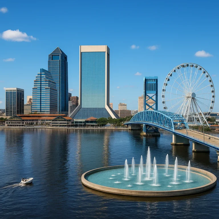
The Lower 48 King: Jacksonville, Florida
- Total Land Area: ~747 square miles (land only) / ~874 square miles (total area).
- Population: ~949,0.
- The Vibe: A sprawling metropolis with beaches, rivers, and suburbs that stretch for miles.
- Why it Wins: Thanks to the 1968 consolidation, Jacksonville absorbed all the unincorporated land in Duval County. While other Florida cities like Miami or Tampa are surrounded by independent suburbs, Jacksonville is the county.
Jax Facts™ Insight: We often get asked, “Is Jacksonville really a city?” The answer is yes, but it’s a unique hybrid. It functions as a city government but covers a geographic area that would be a county in most other states. This is why our traffic can feel so different from Atlanta or Houston; we have to manage infrastructure for a massive rural expanse alongside our urban core.
📏 Beyond the Headlines: Understanding City Limits, Consolidated Governments, and Census Designations
To truly understand the rankings, you have to peel back the layers of bureaucracy. The confusion often stems from mixing up Municipal Boundaries, Census Designated Places (CDPs), and Metropolitan Statistical Areas (MSAs).
The Three Ways to Measure a City
| Measurement Type | Definition | Example | Why it matters |
|---|---|---|---|
| Municipal Boundaries | The legal city limits where the local government has jurisdiction. | Jacksonville (874 sq mi) vs. New York City (302 sq mi) | This is the metric for “largest city by land area.” |
| Metropolitan Statistical Area (MSA) | A region centered on a core city, including surrounding counties with economic ties. | New York Metro (13,0+ sq mi) | This measures the “real” economic size, not the legal city size. |
| Urbanized Area | The densely populated core and its immediate suburbs, regardless of political lines. | Los Angeles Urban Area | This shows where people actually live in a continuous urban fabric. |
The Consolidated City-County Phenomenon
This is the secret weapon of the top land-wise cities.
- How it works: A city and its surrounding county merge into a single government entity.
- The Result: The city’s boundaries become the county’s boundaries.
- Examples:
Jacksonville, FL (Duval County)
Anchorage, AK (Anchorage Municipality)
Nashville, TN (Davidson County)
Philadelphia, PA (Philadelphia County – technically consolidated)
In contrast, cities like San Francisco or Boston are small because they are confined to their original municipal limits, even though their metro areas are massive.
Why the Confusion?
Many people assume “largest city” means “most people.” When they hear “New York is the largest,” they think of population. But when geographers say “largest,” they mean square miles.
- New York City: 8.8 million people in 302 sq miles.
- Sitka, AK: 8,0 people in 2,870 sq miles.
If you want to see how this plays out in real-time, check out the U.S. Census Bureau’s data on incorporated places by area.
🗺️ The Top 15 Largest U.S. Cities by Square Miles: A Deep Dive into American Geography
Let’s get into the nitty-gritty. Here is the definitive list of the top 15 largest U.S. cities by land area. Note that Alaska dominates the top spots, but the Lower 48 has some heavy hitters too.
The Top 15 List
- Sitka, Alaska – ~2,870 sq mi
- Juneau, Alaska – ~2,704 sq mi
- Wrangell, Alaska – ~2,541 sq mi
- Anchorage, Alaska – ~1,946 sq mi
- Jacksonville, Florida – ~747 sq mi (Land only)
- Anaconda, Montana – ~738 sq mi
- Bute, Montana – ~725 sq mi
- Oklahoma City, Oklahoma – ~620 sq mi
- Houston, Texas – ~671 sq mi (Note: Some sources rank Houston higher due to water inclusions, but land-wise it’s usually #9 or #10)
- Phoenix, Arizona – ~519 sq mi
- San Antonio, Texas – ~504 sq mi
- Los Angeles, California – ~501 sq mi
- Columbus, Ohio – ~23 sq mi (Wait, why is Columbus here? It’s a consolidated city-county!)
- Charlotte, North Carolina – ~308 sq mi
- Indianapolis, Indiana – ~361 sq mi
Note: Rankings can shift slightly depending on whether water area is included. We prioritize land area for consistency.
The Alaska Dominance
Notice the pattern? The top four are all in Alaska. This isn’t a coincidence. Alaska’s unique geography allows cities to encompass massive wilderness areas.
- Sitka: Includes forests, mountains, and islands.
- Juneau: Includes the Tongass National Forest and glaciers.
- Wrangell: Includes the Wrangell-St. Elias National Park area.
The Lower 48 Contenders
Once we leave Alaska, the numbers drop significantly.
- Jacksonville is the clear winner in the contiguous U.S.
- Oklahoma City and Houston are close behind, having expanded their boundaries through aggressive annexation in the mid-20th century.
- Phoenix and Los Angeles are massive, but they are still smaller than Jacksonville.
Fun Fact: If you combined the land area of the top 5 cities in the Lower 48, you’d still only have about 3,0 square miles. Sitka alone has 2,870!
🌵 Alaska’s Massive Anomalies: Why Sitka and Wrangell Dominate the Rankings
Why does Alaska have such huge cities? It’s not because they have a lot of people; it’s because of how they define a city.
The “City-Borough” System
In the lower 48, a city is usually a small dot inside a larger county. In Alaska, a city can be the entire borough.
- Sitka: When you incorporate as a city in Sitka, you incorporate the whole island and the mainland strip. There are no other towns inside the city limits.
- Wrangell: Similar to Sitka, it encompasses a massive area of the Tongass National Forest.
The Wilderness Factor
These “cities” are mostly wilderness.
- Sitka: Only a small fraction of the land is developed. The rest is forest, water, and mountains.
- Juneau: The capital of Alaska, but you can’t drive there from the rest of the state. It’s a city of feries and planes.
Is it Fair?
Some argue it’s unfair to compare Sitka to Jacksonville.
- Argument for Fairness: They are both incorporated places with a mayor, city council, and police force.
- Argument against Fairness: Sitka is a wilderness preserve with a post office, while Jacksonville is a bustling metropolis.
Jax Facts™ Take: We think it’s a valid comparison legally, but context matters. If you’re looking for a city with a high population density, Sitka isn’t the place. But if you want the largest legal city footprint, it wins hands down.
🏜️ The Contenders: Comparing Huge Cities in the Lower 48 States
Let’s zoom in on the real giants of the contiguous U.S. These are the cities you can actually drive to without a boat or plane.
Jacksonville, Florida: The King of the South
- Land Area: ~747 sq mi.
- Why it’s huge: The 1968 consolidation.
- The Trade-off: While we have the land, we have to manage a massive rural area. This means our per-capita infrastructure costs are different from Miami or Tampa.
- The Benefit: We have room to grow. While other cities are hitting their limits, Jacksonville still has undeveloped land within its city limits.
Oklahoma City, Oklahoma: The Heartland Giant
- Land Area: ~620 sq mi.
- History: OKC has a history of aggressive annexation. They expanded their boundaries to include surrounding areas to prevent other cities from growing.
- The Vibe: A mix of urban core and sprawling suburbs.
Houston, Texas: The Energy Capital
- Land Area: ~671 sq mi.
- The Strategy: Houston has no zoning laws, which allows for rapid, sprawling development.
- Comparison: Houston is slightly larger than Jacksonville in total area, but Jacksonville often ranks higher in land area depending on the water inclusion.
Phoenix, Arizona: The Desert Metropolis
- Land Area: ~519 sq mi.
- Growth: Phoenix has expanded rapidly, swallowing up desert land.
- The Challenge: Water scarcity is a major issue for such a large city in the desert.
Los Angeles, California: The City of Angels
- Land Area: ~501 sq mi.
- The Paradox: LA is famous for its sprawl, but its city limits are actually smaller than you think. The “LA Metro” is huge, but the city itself is constrained by mountains and other cities.
🚗 Urban Sprawl vs. Rural Expanse: What Does “City” Really Mean in America?
This is the million-dollar question. If a city is mostly empty land, is it really a “city”?
The Definition of “Urban”
The U.S. Census Bureau defines an Urban Area based on population density, not city limits.
- Jacksonville: Has a large urban core, but also vast rural areas within its city limits.
- New York City: Almost entirely urban.
The “City” Label
In the U.S., “city” is a legal term.
- Legal City: An incorporated municipality with a charter.
- Urban Area: A densely populated region.
The Consequences
- Taxation: In Jacksonville, you pay city taxes even if you live in a rural area. In other states, you might pay county taxes only.
- Services: Jacksonville provides services (police, fire, water) to a massive rural area. Other cities don’t.
Jax Facts™ Insight: This is why we often joke that Jacksonville is “the size of Rhode Island but with the traffic of Atlanta.” We have the land, but we’re trying to build a city on it.
📊 Population Density Paradox: Why the Biggest Cities Aren’t Always the Most Crowded
Let’s look at the numbers.
| City | Land Area (sq mi) | Population | Density (per sq mi) |
|---|---|---|---|
| Sitka, AK | 2,870 | 8,458 | ~3 |
| Jacksonville, FL | 747 | 949,0 | ~1,270 |
| New York, NY | 302 | 8,804,0 | ~29,0 |
| Los Angeles, CA | 501 | 3,90,0 | ~7,80 |
The Takeaway
- Sitka is the largest by land, but the least dense.
- New York is tiny by land, but the most dense.
- Jacksonville is in the middle: large land, moderate density.
This paradox explains why people get confused. When we say “largest city,” we usually mean population. But geographically, the largest city is a ghost town.
🌍 Global Comparisons: How U.S. Land Giants Stack Up Against the World’s Largest Cities
How do our American giants compare to the rest of the world?
The World’s Largest Cities by Land Area
- ** Hulunbuir, China:** ~94,0 sq mi (Yes, it’s a city!)
- Altay, China: ~17,0 sq mi
- Hohot, China: ~6,70 sq mi
- Sitka, USA: ~2,870 sq mi
The Difference
In China, “cities” can encompass entire prefectures, including vast rural areas. In the U.S., our cities are smaller, but our metropolitan areas are huge.
- New York Metro: ~13,0 sq mi (larger than many countries).
- Tokyo Metro: ~13,0 sq mi.
The U.S. Advantage
The U.S. has a unique system where cities are small, but metros are huge. This allows for suburban growth without expanding city limits.
Jax Facts™ Insight: If you’re looking for the largest urban area, New York wins. If you’re looking for the largest legal city, Sitka wins. It depends on what you’re measuring!
💡 Quick Tips and Facts for the Curious Traveler
Planning a trip to these massive cities? Here’s what you need to know.
Visiting Sitka, Alaska
- Transport: No roads to the rest of the state. You need a ferry or plane.
- Attractions: Sitka National Historical Park, Alaska Raptor Center.
- Tip: Bring bug spray. The wilderness is real!
Visiting Jacksonville, Florida
- Transport: Major airport (JAX), I-95, I-10.
- Attractions: Jacksonville Beach, Everbank Stadium, Cumer Museum.
- Tip: Don’t try to drive across the whole city in one day. It’s too big!
Visiting Oklahoma City
- Transport: OKC Airport, I-35, I-4.
- Attractions: Oklahoma City National Memorial, Bricktown.
- Tip: Rent a car. Public transit is limited.
Visiting Houston, Texas
- Transport: IAH Airport, I-10, I-45.
- Attractions: Space Center Houston, Museum District.
- Tip: Traffic is legendary. Plan your route carefully.
🏁 Conclusion: The Final Verdict on America’s Land-Wise Titans

So, what is the largest city in the United States land-wise? The answer is Sitka, Alaska. It is a legal city that encompasses nearly 3,0 square miles of land, dwarfing even the most expansive cities in the lower 48.
However, if you strip away Alaska’s unique geography and focus on the contiguous U.S., Jacksonville, Florida takes the crown. Thanks to its 1968 consolidation, Jacksonville is a massive entity that combines urban and rural life in a way few other cities can.
The Final Word
- Largest by Land: Sitka, AK
- Largest in Lower 48: Jacksonville, FL
- Largest by Population: New York City, NY
- Largest Metro Area: New York City, NY (by population) and New York Metro (by land).
The confusion arises because we use “city” to mean different things. Legally, Sitka is the biggest. Economically and demographically, New York is the giant. And for us in Jacksonville, we’re proud to be the biggest in the South, with room to grow and a unique blend of city and country.
Whether you’re a fan of the snowy wilderness of Sitka or the sunny sprawl of Jacksonville, the diversity of American geography is what makes this country so fascinating. So, the next time someone asks, “What’s the biggest city?” you can impress them with the full story.
🔗 Recommended Links for Further Exploration
Want to dive deeper? Here are some great resources:
- U.S. Census Bureau: Gazetter Files – The official source for city area data.
- Alaska Division of Community Advocacy: Alaska City-Boroughs – Learn about the unique Alaska system.
- Jacksonville Consolidation History: Jax Facts™ Jacksonville History – Our deep dive into the 1968 merger.
- Book: The City in History by Lewis Mumford – A classic look at urban development. Find on Amazon
- Book: American Metropolis by Kevin Baker – A look at the evolution of American cities. Find on Amazon
👉 Shop for Maps and Geography Gear:
- National Geographic Maps: National Geographic Store
- Ancestry.com: Trace your city roots
❓ Frequently Asked Questions (FAQ)

Is Jacksonville the largest city in the US?
No, not by land area. Sitka, Alaska is the largest city in the U.S. by land area. However, Jacksonville is the largest city in the contiguous 48 states by land area.
Read more about “Is Jacksonville the largest city in the US?”
What are the 10 largest cities in the United States?
By land area, the top 10 are:
- Sitka, AK
- Juneau, AK
- Wrangell, AK
- Anchorage, AK
- Jacksonville, FL
- Anaconda, MT
- Bute, MT
- Oklahoma City, OK
- Houston, TX
- Phoenix, AZ
Read more about “🌍 Jacksonville Size Comparison: Bigger Than Rhode Island? (2026)”
What is the largest city in the contiguous 48 states?
Jacksonville, Florida is the largest city in the contiguous 48 states by land area, with approximately 747 square miles of land.
Read more about “🐆 15 Fun Facts About the Jacksonville Jaguars You Won’t Believe (2026)”
What is the largest city in America land wise?
Sitka, Alaska is the largest city in America by land area, covering over 2,870 square miles.
Read more about “🤯 How Big Is Orlando? The Shocking Truth About Size (2026)”
Is Jacksonville the largest city in the US by land area?
No. While Jacksonville is the largest in the lower 48, Sitka, Alaska is larger. Sitka’s land area is nearly four times that of Jacksonville.
Read more about “🏡 Is Jax a Good Place to Live? 15 Surprising Pros & 12 Real Cons (2026)”
How does Jacksonville’s land size compare to other major US cities?
Jacksonville is significantly larger than other major cities. For example:
- Jacksonville: ~747 sq mi
- Houston: ~671 sq mi
- Phoenix: ~519 sq mi
- Los Angeles: ~501 sq mi
- New York City: ~302 sq mi
Read more about “🏛️ 25+ Jaw-Dropping Jacksonville History Facts You Never Knew (2026)”
Why is Jacksonville Florida the biggest city in the United States by square miles?
Jacksonville is the biggest in the lower 48 because of the 1968 consolidation with Duval County. This merger expanded the city limits to cover the entire county, including vast rural areas. Other cities did not consolidate, so their boundaries remained small.
Read more about “The 15 Largest Cities in the U.S. by Area (2026) 🌆”
What makes Jacksonville the largest city in the US by land mass?
The consolidated city-county structure makes Jacksonville unique. By merging with the county, Jacksonville absorbed all the unincorporated land, creating a massive geographic footprint. This is a legal and historical anomaly that sets it apart from other major U.S. cities.
Read more about “What Makes Jacksonville FL Unique? 22 Surprising Reasons to Love Jax 🌴”
📚 Reference Links and Data Sources
- U.S. Census Bureau: 2020 Census Redistricting Data
- Wikipedia: List of United States cities by area
- Living Legacy LLC: Largest Cities in America
- Checkli: 10 Largest U.S. Cities (By Land Area)
- Alaska Department of Commerce: Alaska City and Borough Data
- City of Jacksonville: Official Website
- City of Sitka: Official Website
- City of Oklahoma City: Official Website
- City of Houston: Official Website
- City of Phoenix: Official Website